
Taubenberg topographic map
Interactive map
Click on the map to display elevation.
About this map
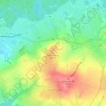
Name: Taubenberg topographic map, elevation, terrain.
Location: Taubenberg, Dresda, Sassonia, 01328, Germania (51.05756 13.86811 51.05766 13.86821)
Average elevation: 270 m
Minimum elevation: 233 m
Maximum elevation: 320 m
Other topographic maps
Click on a map to view its topography, its elevation and its terrain.