
Galade topographic map
Interactive map
Click on the map to display elevation.
About this map
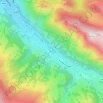
Name: Galade topographic map, elevation, terrain.
Average elevation: 1,027 m
Minimum elevation: 641 m
Maximum elevation: 1,610 m
Other topographic maps
Click on a map to view its topography, its elevation and its terrain.
Payolle
France > Occitania > Hautes Pyrenees > Campan
Payolle, Campan, Bagnères-de-Bigorre, Hautes Pyrenees, Occitania, Metropolitan France, 65710, France
Average elevation: 1,281 m