
Borlez topographic map
Interactive map
Click on the map to display elevation.
About this map
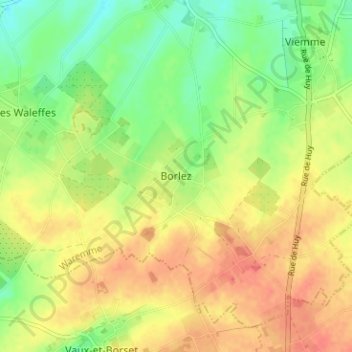
Name: Borlez topographic map, elevation, terrain.
Location: Borlez, Faimes, Waremme, Liège, Wallonie, 4317, Belgique (50.61302 5.22511 50.65302 5.26511)
Average elevation: 162 m
Minimum elevation: 135 m
Maximum elevation: 185 m