
Churriana topographic map
Interactive map
Click on the map to display elevation.
About this map
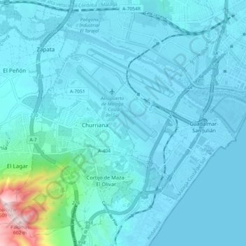
Name: Churriana topographic map, elevation, terrain.
Location: Churriana, Málaga, Andaluzia, Espanha (36.63457 -4.53862 36.70288 -4.44843)
Average elevation: 39 m
Minimum elevation: -4 m
Maximum elevation: 588 m
Other topographic maps
Click on a map to view its topography, its elevation and its terrain.