
Blanden topographic map
Interactive map
Click on the map to display elevation.
About this map
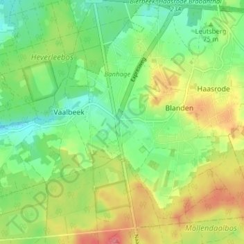
Name: Blanden topographic map, elevation, terrain.
Location: Blanden, Oud-Heverlee, Vlaams-Brabant, Vlaanderen, 3052, België (50.80546 4.68328 50.84546 4.72328)
Average elevation: 71 m
Minimum elevation: 43 m
Maximum elevation: 109 m