
Le Paraclet topographic map
Interactive map
Click on the map to display elevation.
About this map
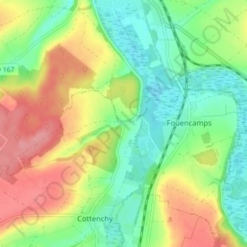
Name: Le Paraclet topographic map, elevation, terrain.
Average elevation: 61 m
Minimum elevation: 22 m
Maximum elevation: 115 m
Other topographic maps
Click on a map to view its topography, its elevation and its terrain.
Bois Magneux
France > Hauts-de-France > Somme > Cottenchy > Le Paraclet
Bois Magneux, Le Paraclet, Cottenchy, Montdidier, Somme, Hauts-de-France, France métropolitaine, 80440, France
Average elevation: 72 m