
Somiedo topographic map
Interactive map
Click on the map to display elevation.
About this map
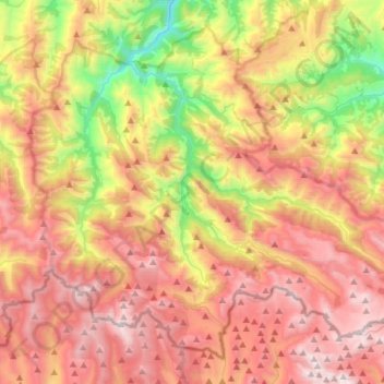
Name: Somiedo topographic map, elevation, terrain.
Location: Somiedo, Astúrias, Espanha (43.00891 -6.37732 43.19673 -6.07990)
Average elevation: 1,299 m
Minimum elevation: 346 m
Maximum elevation: 2,171 m
Other topographic maps
Click on a map to view its topography, its elevation and its terrain.
Les Potes
Espanha > Astúrias > Somiedo > Braña el Tornu
Les Potes, Braña el Tornu, Somiedo, Astúrias, 33842, Espanha
Average elevation: 988 m