
Kondalilla National Park topographic map
Interactive map
Click on the map to display elevation.
About this map
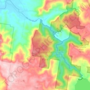
Name: Kondalilla National Park topographic map, elevation, terrain.
Average elevation: 289 m
Minimum elevation: 108 m
Maximum elevation: 485 m
Other topographic maps
Click on a map to view its topography, its elevation and its terrain.
Eudlo Creek
Australia > Queensland > Maroochydore
Eudlo Creek, Diddillibah, Maroochydore, Sunshine Coast Regional, Queensland, 4558, Australia
Average elevation: 7 m
Maroochydore
Australia > Queensland > Maroochydore
Maroochydore, Queensland, 4558, Australia
Average elevation: 20 m