
Poulo topographic map
Interactive map
Click on the map to display elevation.
About this map
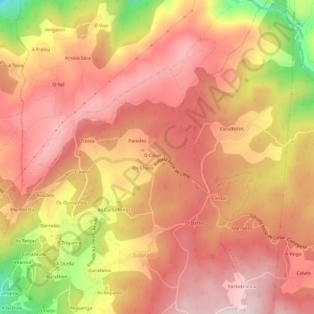
Name: Poulo topographic map, elevation, terrain.
Location: Poulo, Gomesende, Tierra de Celanova, Orense, Galicia, España (42.18145 -8.11439 42.22371 -8.07322)
Average elevation: 443 m
Minimum elevation: 150 m
Maximum elevation: 591 m
Other topographic maps
Click on a map to view its topography, its elevation and its terrain.
Gomesende
España > Galicia > Tierra de Celanova > Gomesende
Gomesende, Tierra de Celanova, Orense, Galicia, 32212, España
Average elevation: 397 m