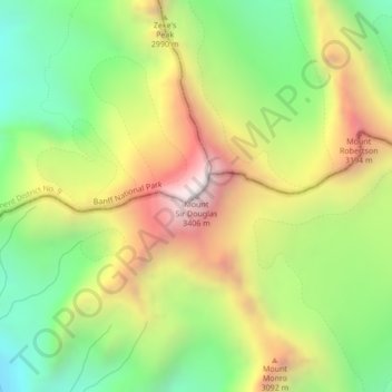
Mount Sir Douglas topographic map
Interactive map
Click on the map to display elevation.
About this map
Name: Mount Sir Douglas topographic map, elevation, terrain.
Average elevation: 2,737 m
Minimum elevation: 2,222 m
Maximum elevation: 3,387 m

Click on the map to display elevation.
Name: Mount Sir Douglas topographic map, elevation, terrain.
Average elevation: 2,737 m
Minimum elevation: 2,222 m
Maximum elevation: 3,387 m