
Thank you for supporting this site ❤️
Make a donation
Make a donation
Craichie topographic map
Click on the map to display elevation.
Thank you for supporting this site ❤️
Make a donation
Make a donation
About this map
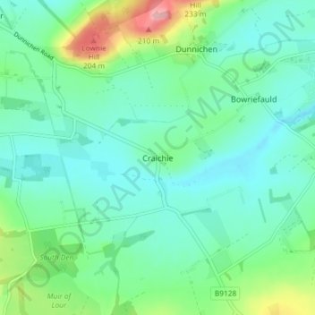
Name: Craichie topographic map, elevation, terrain.
Location: Craichie, Angus, Scotland, DD8 2LU, United Kingdom (56.59463 -2.83123 56.63463 -2.79123)
Average elevation: 121 m
Minimum elevation: 89 m
Maximum elevation: 225 m
Thank you for supporting this site ❤️
Make a donation
Make a donation
Other topographic maps
Click on a map to view its topography, its elevation and its terrain.
Thank you for supporting this site ❤️
Make a donation
Make a donation
Thank you for supporting this site ❤️
Make a donation
Make a donation
Thank you for supporting this site ❤️
Make a donation
Make a donation
Thank you for supporting this site ❤️
Make a donation
Make a donation