
Montemaior topographic map
Interactive map
Click on the map to display elevation.
About this map
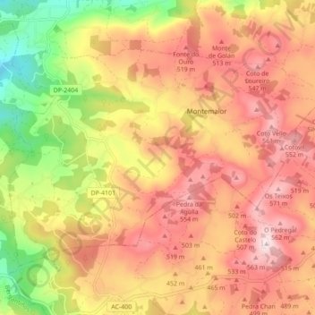
Name: Montemaior topographic map, elevation, terrain.
Location: Montemaior, A Laracha, Bergantiños, Corunha, Galiza, Espanha (43.16498 -8.59662 43.20861 -8.50995)
Average elevation: 424 m
Minimum elevation: 191 m
Maximum elevation: 591 m