
Vail topographic map
Interactive map
Click on the map to display elevation.
About this map
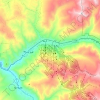
Name: Vail topographic map, elevation, terrain.
Location: Vail, Eagle County, Colorado, 81657, United States (39.61496 -106.43944 39.65077 -106.27975)
Average elevation: 2,953 m
Minimum elevation: 2,342 m
Maximum elevation: 3,692 m
Vail's average elevation is 8,150 feet (2,480 m) above sea level. The town has a total area of 4.5 square miles (12 km2), with no lakes (there is, however, at least one pond). Gore Creek flows from east to west through the center of town.