
Saraghrar I topographic map
Interactive map
Click on the map to display elevation.
About this map
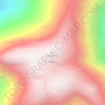
Name: Saraghrar I topographic map, elevation, terrain.
Location: Saraghrar I, Chitrāl District, Khyber Pakhtunkhwa, Pakistan (36.54748 72.11547 36.54758 72.11557)
Average elevation: 6,780 m
Minimum elevation: 5,536 m
Maximum elevation: 7,336 m
Other topographic maps
Click on a map to view its topography, its elevation and its terrain.
Tirich Mir
Tirich Mir, Chitrāl District, Khyber Pakhtunkhwa, Pakistan
Average elevation: 6,886 m
Chitral
Pakistan > Khyber Pakhtunkhwa > Lower Chitral District > Chitral
Chitral, Lower Chitral District, Khyber Pakhtunkhwa, 7200, Pakistan
Average elevation: 2,982 m