
Clark County topographic map
Interactive map
Click on the map to display elevation.
About this map
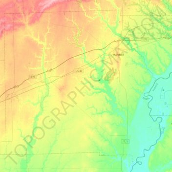
Name: Clark County topographic map, elevation, terrain.
Location: Clark County, Illinois, United States (39.15661 -88.01397 39.48853 -87.53108)
Average elevation: 178 m
Minimum elevation: 127 m
Maximum elevation: 251 m
Other topographic maps
Click on a map to view its topography, its elevation and its terrain.
Olney
United States > Illinois > Richland County
Olney, Richland County, Illinois, 62450, United States
Average elevation: 143 m