
Mogami topographic map
Interactive map
Click on the map to display elevation.
About this map
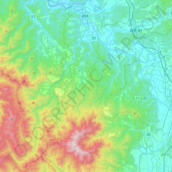
Name: Mogami topographic map, elevation, terrain.
Location: Ohkura, Mogami, Yamagata Prefecture, Tohoku, Japan (38.49330 140.03499 38.73372 140.26573)
Average elevation: 378 m
Minimum elevation: 26 m
Maximum elevation: 1,444 m
Other topographic maps
Click on a map to view its topography, its elevation and its terrain.