
Murehwa topographic map
Interactive map
Click on the map to display elevation.
About this map
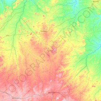
Name: Murehwa topographic map, elevation, terrain.
Location: Murehwa, Mashonaland East Province, Zimbabwe (-18.21387 31.51577 -17.39377 32.20787)
Average elevation: 1,300 m
Minimum elevation: 989 m
Maximum elevation: 1,765 m
Other topographic maps
Click on a map to view its topography, its elevation and its terrain.
Chivhu
Zimbabwe > Mashonaland East Province > Chikomba
Chivhu, Chikomba, Mashonaland East Province, Zimbabwe
Average elevation: 1,447 m
Pa Cross
Zimbabwe > Mashonaland East Province > Murehwa
Pa Cross, Murehwa, Mashonaland East Province, Zimbabwe
Average elevation: 1,219 m