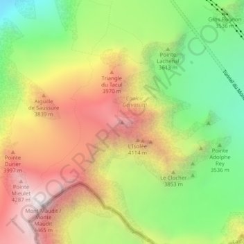
Mont Blanc du Tacul topographic map
Interactive map
Click on the map to display elevation.
About this map
Name: Mont Blanc du Tacul topographic map, elevation, terrain.
Average elevation: 3,638 m
Minimum elevation: 2,884 m
Maximum elevation: 4,451 m

Click on the map to display elevation.
Name: Mont Blanc du Tacul topographic map, elevation, terrain.
Average elevation: 3,638 m
Minimum elevation: 2,884 m
Maximum elevation: 4,451 m