
Chitral topographic map
Interactive map
Click on the map to display elevation.
About this map
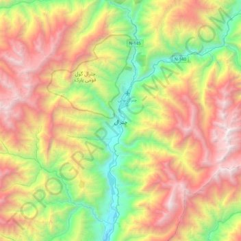
Name: Chitral topographic map, elevation, terrain.
Average elevation: 2,982 m
Minimum elevation: 1,358 m
Maximum elevation: 5,126 m
The city has an average elevation of 1,500 m (4,921 ft).