
Dan Chang topographic map
Interactive map
Click on the map to display elevation.
About this map
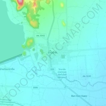
Name: Dan Chang topographic map, elevation, terrain.
Location: Dan Chang, Suphan Buri Province, Thailand (14.79963 99.65279 14.87963 99.73279)
Average elevation: 83 m
Minimum elevation: 56 m
Maximum elevation: 321 m