
Williams Wharf topographic map
Interactive map
Click on the map to display elevation.
About this map
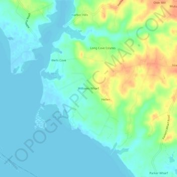
Name: Williams Wharf topographic map, elevation, terrain.
Location: Williams Wharf, Calvert County, Maryland, 20615, USA (38.42373 -76.60718 38.46373 -76.56718)
Average elevation: 13 m
Minimum elevation: -3 m
Maximum elevation: 42 m