
Doha topographic map
Interactive map
Click on the map to display elevation.
Doha
Doha is located on the central-east portion of Qatar, bordered by the Persian Gulf on its coast. Its elevation is 10 m (33 ft). Doha is highly urbanized. Land reclamation off the coast has added 400 hectares of land and 30 km of coastline. Half of the 22 km² of surface area which Hamad International Airport was constructed on was reclaimed land. The geology of Doha is primarily composed of weathered unconformity on the top of the Eocene period Dammam Formation, forming dolomitic limestone.
About this map
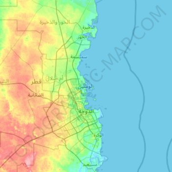
Name: Doha topographic map, elevation, terrain.
Location: Doha, Qatar (25.15054 51.39577 25.39297 51.64708)
Average elevation: 11 m
Minimum elevation: -4 m
Maximum elevation: 37 m