
Thank you for supporting this site ❤️
Make a donation
Make a donation
Melfort topographic map
Click on the map to display elevation.
Thank you for supporting this site ❤️
Make a donation
Make a donation
About this map
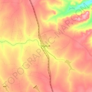
Name: Melfort topographic map, elevation, terrain.
Location: Melfort, Goromonzi, Mashonaland East, Zimbabwe (-18.04706 31.28567 -17.96706 31.36567)
Average elevation: 1,517 m
Minimum elevation: 1,397 m
Maximum elevation: 1,575 m
Thank you for supporting this site ❤️
Make a donation
Make a donation