
Thank you for supporting this site ❤️
Make a donation
Make a donation
Midlands topographic map
Click on the map to display elevation.
Thank you for supporting this site ❤️
Make a donation
Make a donation
About this map
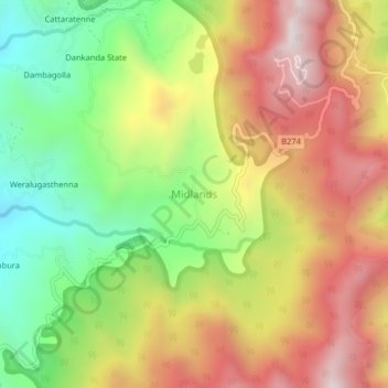
Name: Midlands topographic map, elevation, terrain.
Location: Midlands, Matale District, Central Province, Sri Lanka (7.49325 80.70323 7.53325 80.74323)
Average elevation: 975 m
Minimum elevation: 506 m
Maximum elevation: 1,455 m
Thank you for supporting this site ❤️
Make a donation
Make a donation