
Thank you for supporting this site ❤️
Make a donation
Make a donation
Boyacá topographic map
Click on the map to display elevation.
Thank you for supporting this site ❤️
Make a donation
Make a donation
About this map
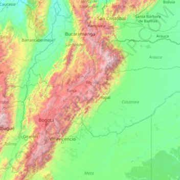
Name: Boyacá topographic map, elevation, terrain.
Location: Boyacá, Colombia (3.02790 -75.42686 8.22790 -70.22686)
Average elevation: 851 m
Minimum elevation: 26 m
Maximum elevation: 5,204 m
Thank you for supporting this site ❤️
Make a donation
Make a donation
Other topographic maps
Click on a map to view its topography, its elevation and its terrain.