
Thailand topographic map
Interactive map
Click on the map to display elevation.
About this map
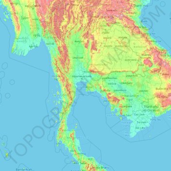
Name: Thailand topographic map, elevation, terrain.
Location: Thailand (5.61285 97.34381 20.46483 105.63681)
Average elevation: 156 m
Minimum elevation: -3 m
Maximum elevation: 2,557 m
Other topographic maps
Click on a map to view its topography, its elevation and its terrain.
Phra Borom Maha Ratchawang Subdistrict
Thailand > Bangkok > Phra Nakhon District > Bangkok
Average elevation: 4 m