
Virgin Gorda topographic map
Interactive map
Click on the map to display elevation.
Virgin Gorda
One of the great harbors of the world, North Sound, and historically Gorda Sound, lies at the northeast end of the island. It is bordered by four islands and connecting reef systems that keep the sound calm, creating one of the world's great watersports meccas, with over 3,000 acres (1,200 ha) of protected waters. At the eastern end of the sound is the premier anchorage, in the lee of Biras Hill (elevation 435 ft (133 m)). The village, resort, and marina at this point (Jon'O'Point) is called the Bitter End Yacht Club, and runs for about a mile of coastline.
About this map
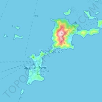
Name: Virgin Gorda topographic map, elevation, terrain.
Average elevation: 11 m
Minimum elevation: -1 m
Maximum elevation: 404 m