Geolocate

Bygland topographic map

Interactive map

Click on the map to display elevation.

About this map

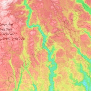
Name: Bygland topographic map, elevation, terrain.

Location: Bygland, Agder, Norway (58.64591 7.03259 59.09814 8.01684)

Average elevation: 662 m

Minimum elevation: 158 m

Maximum elevation: 1,294 m

Other topographic maps

Click on a map to view its topography, its elevation and its terrain.

Svenskøya

Norway

Average elevation: 16 m

Håkøya

Norway > Troms og Finnmark > Tromsø

Average elevation: 8 m

Rostad

Norway > Rostad

Average elevation: 44 m

Rørvik

Norway > Rørvik

Average elevation: 30 m

Høyen

Norway > Høyen

Average elevation: 80 m

Engesland

Norway > Engesland

Average elevation: 296 m

Sør-Rokta

Norway > Steinkjer

Average elevation: 214 m

Sogndal

Norway > Vestland > Sogndal

Average elevation: 316 m