
Krabi Province topographic map
Interactive map
Click on the map to display elevation.
About this map
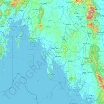
Name: Krabi Province topographic map, elevation, terrain.
Location: Krabi Province, Thailand (6.99932 98.60381 8.67500 99.34750)
Average elevation: 65 m
Minimum elevation: -3 m
Maximum elevation: 1,640 m
Other topographic maps
Click on a map to view its topography, its elevation and its terrain.