
Mutungagore topographic map
Interactive map
Click on the map to display elevation.
About this map
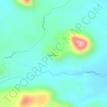
Name: Mutungagore topographic map, elevation, terrain.
Location: Mutungagore, Shamva, Mashonaland Central, Zimbabwe (-16.95012 31.81790 -16.95002 31.81800)
Average elevation: 921 m
Minimum elevation: 863 m
Maximum elevation: 1,113 m
Other topographic maps
Click on a map to view its topography, its elevation and its terrain.
Ruya River
Zimbabwe > Mashonaland Central
Ruya River, Bindura, Mashonaland Central, Zimbabwe
Average elevation: 1,187 m
Bindura
Zimbabwe > Mashonaland Central
Bindura, Mashonaland Central, Zimbabwe
Average elevation: 1,186 m
Mount Darwin
Zimbabwe > Mashonaland Central
Mount Darwin, Mashonaland Central, Zimbabwe
Average elevation: 801 m
Mazowe River
Zimbabwe > Mashonaland Central
Mazowe River, Mazowe, Mashonaland Central, Zimbabwe
Average elevation: 1,127 m
Centenary
Zimbabwe > Mashonaland Central > Centenary
Centenary, Muzarabani, Mashonaland Central, Zimbabwe
Average elevation: 1,199 m