
Worcester County topographic map
Interactive map
Click on the map to display elevation.
About this map
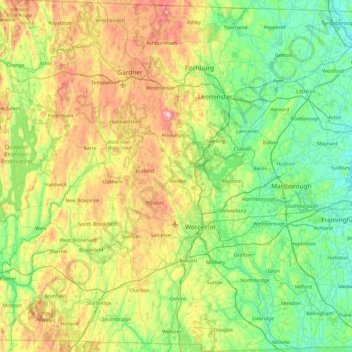
Name: Worcester County topographic map, elevation, terrain.
Location: Worcester County, Massachusetts, United States of America (42.00807 -72.31491 42.72161 -71.47799)
Average elevation: 201 m
Minimum elevation: 41 m
Maximum elevation: 605 m