
San Luis Potosi topographic map
Interactive map
Click on the map to display elevation.
About this map
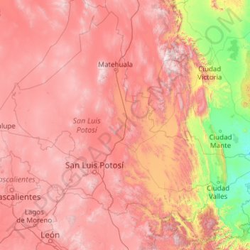
Name: San Luis Potosi topographic map, elevation, terrain.
Location: San Luis Potosi, Mexico (21.16015 -102.29604 24.49152 -98.32597)
Average elevation: 1,513 m
Minimum elevation: 11 m
Maximum elevation: 3,462 m