
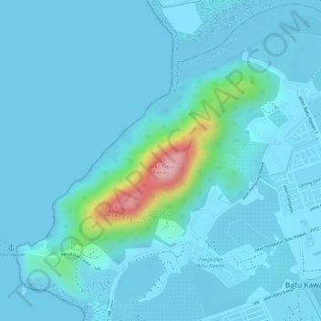
Bukit Batu Kawan topographic map
Interactive map
Click on the map to display elevation.
About this map
Name: Bukit Batu Kawan topographic map, elevation, terrain.
Average elevation: 18 m
Minimum elevation: -7 m
Maximum elevation: 180 m
Other topographic maps
Click on a map to view its topography, its elevation and its terrain.
Sungai Bakap
Malaysia > Penang > Nibong Tebal
Sungai Bakap, Nibong Tebal, Seberang Perai Selatan, Province Wellesley, Penang, 14200, Malaysia
Average elevation: 7 m
Nibong Tebal
Malaysia > Penang > Nibong Tebal
Nibong Tebal, Seberang Perai Selatan, Province Wellesley, Penang, 14300, Malaysia
Average elevation: 22 m
Sungai Bakap
Malaysia > Penang > Nibong Tebal
Sungai Bakap, Nibong Tebal, Seberang Perai Selatan, Province Wellesley, Penang, 14200, Malaysia
Average elevation: 8 m