
Nakapiripirit topographic map
Interactive map
Click on the map to display elevation.
About this map
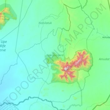
Name: Nakapiripirit topographic map, elevation, terrain.
Location: Nakapiripirit, Northern Region, Uganda (1.54922 34.22127 2.44252 34.87326)
Average elevation: 1,270 m
Minimum elevation: 1,042 m
Maximum elevation: 3,018 m
Other topographic maps
Click on a map to view its topography, its elevation and its terrain.
Mount Kadam
Mount Kadam, Nakapiripirit, Northern Region, Uganda
Average elevation: 2,532 m