
Miami-Dade County topographic map
Interactive map
Click on the map to display elevation.
About this map
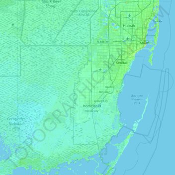
Name: Miami-Dade County topographic map, elevation, terrain.
Location: Miami-Dade County, Florida, United States of America (25.13735 -80.87360 25.97920 -80.04275)
Average elevation: 3 m
Minimum elevation: -2 m
Maximum elevation: 44 m
Other topographic maps
Click on a map to view its topography, its elevation and its terrain.
Alachua County
United States of America > Florida
Alachua County, Florida, United States of America
Average elevation: 33 m