
Boise City topographic map
Interactive map
Click on the map to display elevation.
About this map
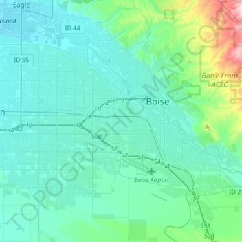
Name: Boise City topographic map, elevation, terrain.
Location: Boise City, Ada County, Idaho, USA (43.50940 -116.36568 43.69206 -116.09419)
Average elevation: 900 m
Minimum elevation: 773 m
Maximum elevation: 1,737 m