
Quartier du Sablon - Zavelwijk topographic map
Interactive map
Click on the map to display elevation.
About this map
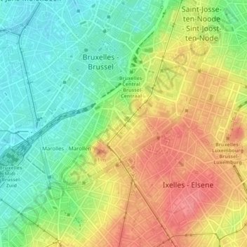
Name: Quartier du Sablon - Zavelwijk topographic map, elevation, terrain.
Average elevation: 54 m
Minimum elevation: 17 m
Maximum elevation: 92 m
Other topographic maps
Click on a map to view its topography, its elevation and its terrain.
Ville de Bruxelles - Stad Brussel
Belgium > Brussels-Capital > Ville de Bruxelles - Stad Brussel
Ville de Bruxelles - Stad Brussel, Brussels-Capital, Belgium
Average elevation: 53 m