
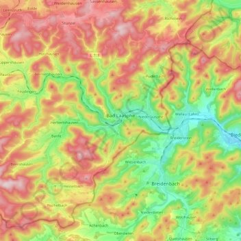
Bad Laasphe topographic map
Interactive map
Click on the map to display elevation.
About this map
Name: Bad Laasphe topographic map, elevation, terrain.
Average elevation: 464 m
Minimum elevation: 272 m
Maximum elevation: 672 m
The highest elevation in the municipal area rises to 694 m. It lies southwest of the main town at the outlying centre of Heiligenborn.