
Central Sulawesi topographic map
Interactive map
Click on the map to display elevation.
About this map
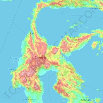
Name: Central Sulawesi topographic map, elevation, terrain.
Location: Central Sulawesi, Indonesia (-4.25378 118.24886 0.86622 123.36886)
Average elevation: 256 m
Minimum elevation: -2 m
Maximum elevation: 3,227 m