
Tierra del Fuego Province topographic map
Interactive map
Click on the map to display elevation.
About this map
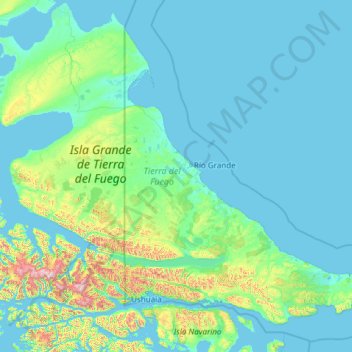
Name: Tierra del Fuego Province topographic map, elevation, terrain.
Location: Tierra del Fuego Province, Argentina (-55.05727 -68.60935 -52.65840 -63.79571)
Average elevation: 135 m
Minimum elevation: -2 m
Maximum elevation: 2,371 m