
Iringa topographic map
Interactive map
Click on the map to display elevation.
About this map
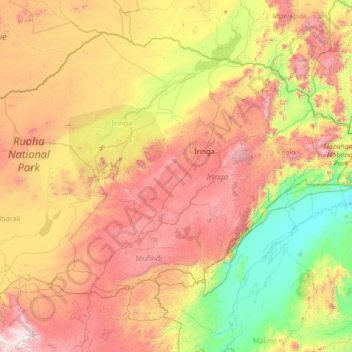
Name: Iringa topographic map, elevation, terrain.
Location: Iringa, Southern Highlands Zone, Tanzania (-9.03242 34.17471 -6.86673 36.95304)
Average elevation: 1,102 m
Minimum elevation: 239 m
Maximum elevation: 2,837 m