
Meerut topographic map
Interactive map
Click on the map to display elevation.
About this map
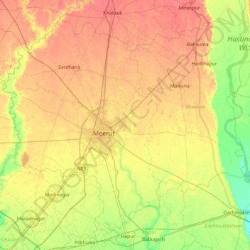
Name: Meerut topographic map, elevation, terrain.
Location: Meerut, Uttar Pradesh, India (28.73691 77.42332 29.26668 78.12487)
Average elevation: 225 m
Minimum elevation: 203 m
Maximum elevation: 246 m
Other topographic maps
Click on a map to view its topography, its elevation and its terrain.