
Ghazni topographic map
Interactive map
Click on the map to display elevation.
About this map
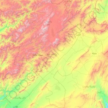
Name: Ghazni topographic map, elevation, terrain.
Location: Ghazni, Afghanistan (32.07582 66.82336 34.21913 68.82773)
Average elevation: 2,528 m
Minimum elevation: 1,413 m
Maximum elevation: 4,717 m