
Kediri topographic map
Interactive map
Click on the map to display elevation.
About this map
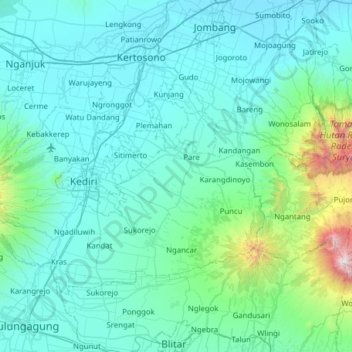
Name: Kediri topographic map, elevation, terrain.
Location: Kediri, East Java, Indonesia (-8.01206 111.79699 -7.59963 112.42225)
Average elevation: 297 m
Minimum elevation: 25 m
Maximum elevation: 2,830 m
Other topographic maps
Click on a map to view its topography, its elevation and its terrain.