
Batna topographic map
Interactive map
Click on the map to display elevation.
About this map
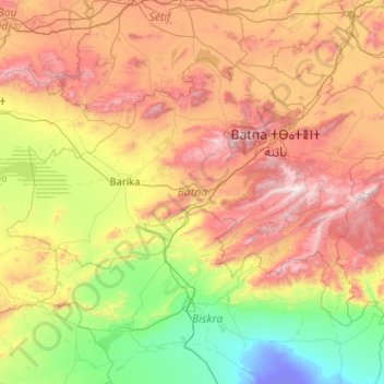
Name: Batna topographic map, elevation, terrain.
Location: Batna, Algeria (34.75362 4.74066 35.92275 6.79281)
Average elevation: 720 m
Minimum elevation: -25 m
Maximum elevation: 2,259 m