
Eichstätt topographic map
Interactive map
Click on the map to display elevation.
About this map
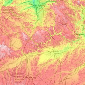
Name: Eichstätt topographic map, elevation, terrain.
Location: Eichstätt, Bavaria, 85072, Germany (48.25181 10.54501 49.53181 11.82501)
Average elevation: 455 m
Minimum elevation: 281 m
Maximum elevation: 684 m
Other topographic maps
Click on a map to view its topography, its elevation and its terrain.