
Viedma topographic map
Interactive map
Click on the map to display elevation.
About this map
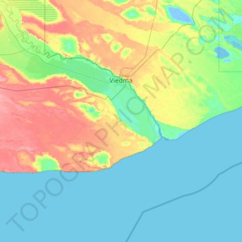
Name: Viedma topographic map, elevation, terrain.
Location: Viedma, Departamento Adolfo Alsina, RN, Argentina (-41.16173 -64.01115 -40.76640 -62.79007)
Average elevation: 19 m
Minimum elevation: -7 m
Maximum elevation: 78 m
Other topographic maps
Click on a map to view its topography, its elevation and its terrain.
Ventisquero Negro
Ventisquero Negro, Sendero Piedra Pérez, Departamento Bariloche, RN, Argentina
Average elevation: 1,177 m