
Embu County topographic map
Interactive map
Click on the map to display elevation.
About this map
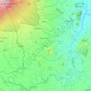
Name: Embu County topographic map, elevation, terrain.
Location: Embu County, Kenya (-0.91816 37.26789 -0.15205 37.93653)
Average elevation: 1,221 m
Minimum elevation: 471 m
Maximum elevation: 5,086 m
Other topographic maps
Click on a map to view its topography, its elevation and its terrain.