
Aurère topographic map
Interactive map
Click on the map to display elevation.
About this map
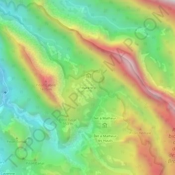
Name: Aurère topographic map, elevation, terrain.
Location: Aurère, La Possession, Saint-Paul, Réunion, 97419, France (-21.03988 55.40402 -20.99988 55.44402)
Average elevation: 863 m
Minimum elevation: 318 m
Maximum elevation: 1,668 m