
Entre-Deux topographic map
Interactive map
Click on the map to display elevation.
About this map
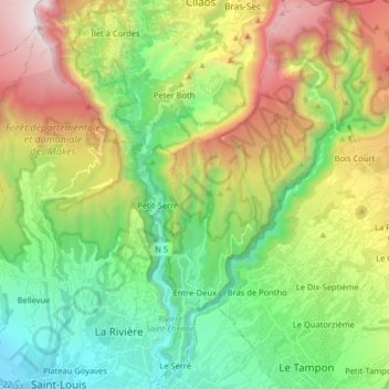
Name: Entre-Deux topographic map, elevation, terrain.
Location: Entre-Deux, Saint-Pierre, Réunion, 97414, France (-21.28583 55.45542 -21.13566 55.53203)
Average elevation: 942 m
Minimum elevation: 6 m
Maximum elevation: 2,630 m